
Where we come from
The story of our house
When we first stood in the dining room of the Masterpiece in 2022, between concrete walls that were once wine vats, we thought: this house has seen a lot. How much exactly, we only understood this summer — with two old maps, one Occitan word and a canal that was once a river.
One word on a map
On the Carte de Cassini, the first complete map of France, drawn before the Revolution, a single word marks our spot: la Jasse. Not a farm or family name, but Occitan for sheepfold. Down here between canal and lagoon, where the land was flat, damp and salty, sheep were kept — and at some point a building was put up for them.
Barely fifty years later the same place is called Bergerie Carbonel: that is how it appears in the Napoleonic cadastre of Narbonne, surveyed in 1825, and how the Carte d'état-major takes it over around 1850. The same function, now in French, plus a name — very probably that of the owner at the time. Carbonel eventually became La Carbonnelle; on the IGN map of 1950 the name is already written the way the house is still called today.
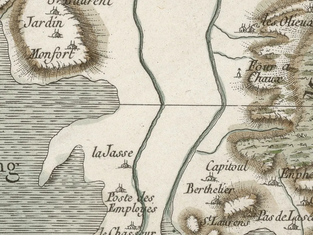
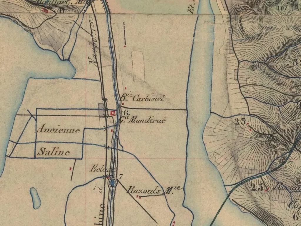
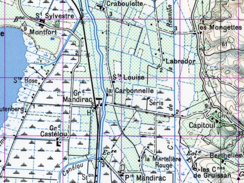
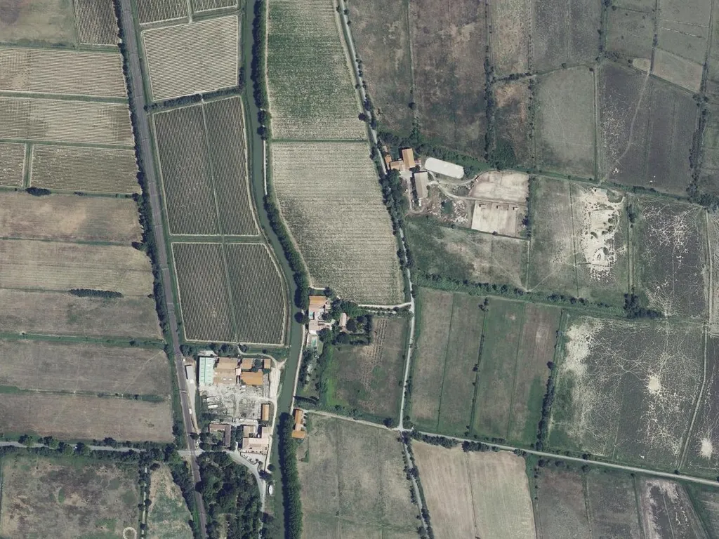
One place, four views: sheepfold, Bergerie Carbonel, La Carbonnelle — and today.
Every map shows the sheepfold where our house stands today: on the bank of the Robine, next to the track that leads east from the canal. Whether our walls are still the same ones, we cannot say for sure — old maps are rough, and the sheepfold may have been rebuilt and extended several times. But the thick walls and the coolness of the ground floor, which our guests appreciate so much in summer, point to a farm building older than anything else standing around it today.
From sheepfold to wine cellar
What turned the sheepfold into a wine estate, the house tells itself. The wing where the Masterpiece is today was made up of five concrete wine vats in which wine was once stored here — we did not tear them out, we moved in: two are now the dining room, one the passageway with the patina, and the last two became the bathroom of the Masterpiece and the bathroom of the Studio. Such cuves en béton belong to the great wine era of the Languedoc: after phylloxera had destroyed the old vineyards at the end of the 19th century, the plain around Narbonne was replanted on a grand scale, and flat land by the canal was cheap and close to transport. The banks of the Robine are still lined with the chais of that period. Somewhere in those years, sheep gave way to wine — here too.
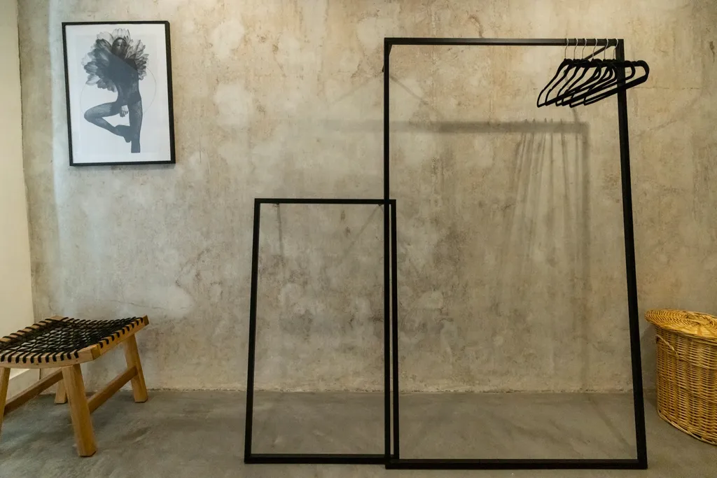
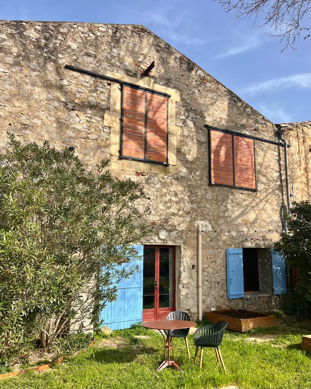
The patina of the old vats in the Masterpiece — and the rubble-stone walls, older than everything that was added later.
On the aerial photograph from the 1950s the house is a small farmstead on the canal, and all around it lie plots with fine parallel rows: vines. They are still there — the path from the canal to the Studio runs right past them.
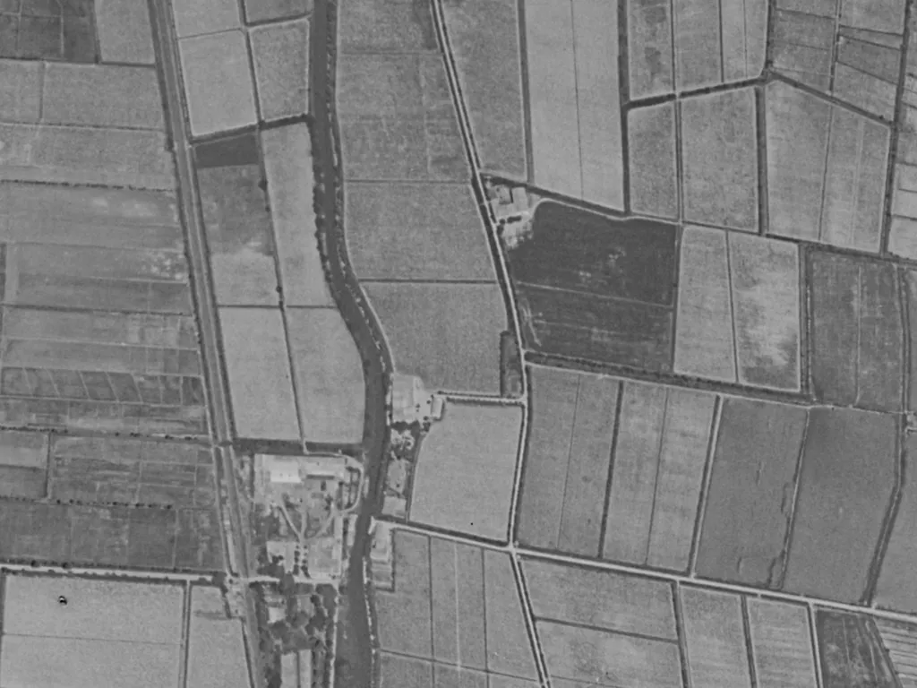
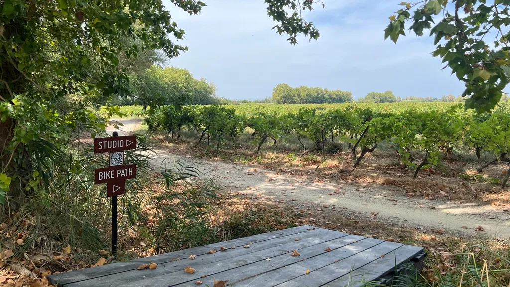
Vines around the house: on the aerial photo of 1950–1965 (© IGN) — and today on the path to the Studio.
What the cadastre reveals: In early September 2026 the answer came from Carcassonne: the complete plans of the Napoleonic cadastre of Narbonne, 83 sheets, surveyed in 1825. On the ninth sheet of section C, there it is, small and drawn in red: the Bergerie Carbonel, plot 752 — a single building right on the towpath, surrounded by the pastures numbered 750 to 761. That makes the name a quarter of a century older than we thought.
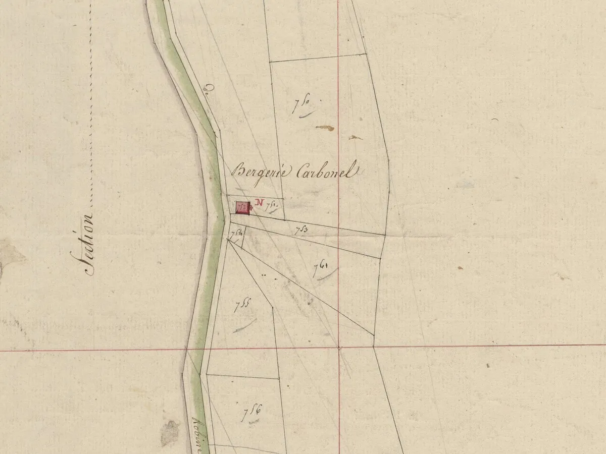
What we do not know yet: Who Carbonel was, and whether it was he who started the wine. The plans show plots, not names — those are in the section register and the tax rolls, which can only be consulted in the reading room in Carcassonne. That is our next winter outing. As soon as we know more, we will continue writing here.
Why a canal flows past our door
Today the Robine looks like a quiet side arm laid out for houseboats and cyclists. In fact it is older than anything else man-made in this landscape — and it was once the river itself.
Narbonne is the oldest Roman colony outside Italy, founded in 118 BC on the Via Domitia, the road from Italy to Spain. The Aude, then called Atax, flowed right through the town and on across the lagoons to the sea; the Romans sailed it by boat down to the coast, and Narbonne became one of the most important ports of the western Mediterranean. The Pont des Marchands, today one of the last inhabited bridges in France, still stands where the Roman road crossed the river.
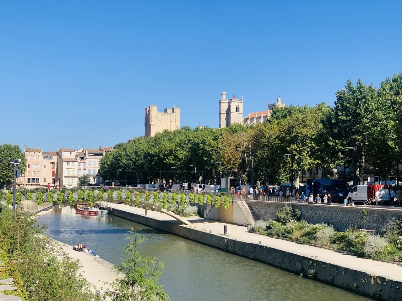
Then, tradition says in the year 1316, came the flood. A huge spate of the Aude devastated the town and found itself a new bed — north of Narbonne, where the river still flows today. The old riverbed through the town ran dry. Narbonne lost its access to the sea, and with it its lifeline.
The people of Narbonne did not give up. They channelled water from the Aude back into the abandoned bed and made it a canal: the Robine — a word that in Occitan simply means “canal”, just as jasse means sheepfold. For centuries it was deepened, straightened, silted up again and rebuilt. Five years after the Canal du Midi opened, the Robine got its first locks in 1686; a junction canal of its own followed a hundred years later — and since 1996 it has been part of the UNESCO World Heritage together with the Canal du Midi.
And what travelled on it? Above all two things that shape this landscape: salt from the salt pans on the étangs and wine from the hinterland, both on barges pulled by horses along the towpath — the same path our guests run along in the morning. On the military map, directly opposite us on the far bank, it says “Ancienne Saline”: the old salt works. And on the Cassini map, a few hundred metres downstream, “Poste des Employés” — probably a post of the officials who collected the salt tax. Whoever kept a sheepfold here lived right on one of the region's most important trade routes — only that it was made of water.
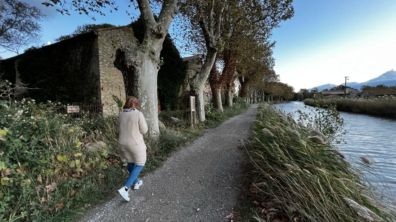
From the town to the sea
To retrace the story you need a bicycle and half a day. From our house it is about 7 kilometres into town to the Pont des Marchands — and a good 20 kilometres the other way to the river mouth. The towpath is a continuous voie verte, flat and car-free.
Towards Narbonne: past the Mandirac lock and the Écluse de Narbonne in the middle of town. At the end: the Pont des Marchands, the cathedral, Les Halles — and the Roman museum Narbo Via, which shows the port city Narbonne once was.
Towards the sea: beyond Mandirac the landscape opens up and falls silent. The canal runs along a narrow embankment between the étangs of Bages and Sigean, water on both sides, salt meadows and flamingos. At Grand Mandirac lies the old boatyard where historic wooden boats are restored. Further south the Île Sainte-Lucie, a nature reserve with pines, old quarries and a view over the whole lagoon, then the salt pans, and finally Port-la-Nouvelle, where the Robine meets the Mediterranean — the place where the salt was once loaded onto ships.
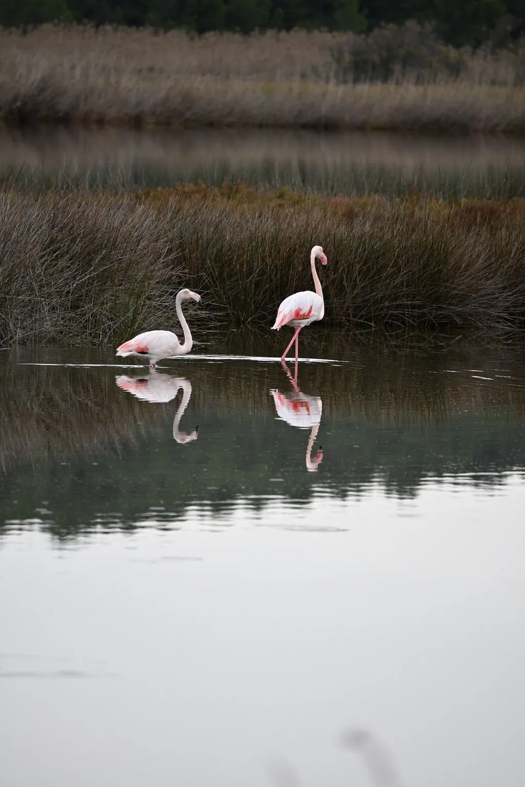
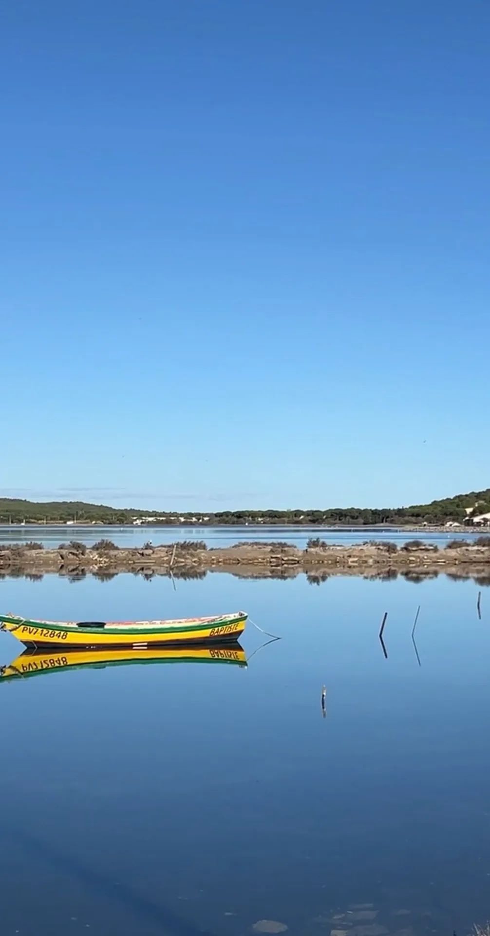
Between the étangs: flamingos and still waterways towards the Île Sainte-Lucie and the sea.
Everything between town and sea is part of the Parc naturel régional de la Narbonnaise — there is more on birds, salt pans and winter light in our winter article, and more on cycling in our cycling article.
Frequently asked questions
- How old is the house, really?
- Honestly: we do not know the exact year. A sheepfold on this spot appears on the Cassini map from the 18th century, and the name Carbonel is recorded in the Napoleonic cadastre by 1825 at the latest. How much of that old fabric survives in our walls is what we are trying to find out through the historical land register.
- Where does the name La Carbonnelle come from?
- Most likely from the “Bergerie Carbonel” recorded at our location in the Napoleonic cadastre of 1825 and on the military map around 1850 — Carbonel was probably the owner’s name. On the 1950 IGN map the place is already called “la Carbonnelle”.
- Are the concrete wine vats real?
- Yes. They are the original cuves in which wine was once stored here — five of them. We deliberately kept them during the renovation: two now form the dining room of the Masterpiece, one the passageway, and two became the bathrooms of the Masterpiece and the Studio.
- Was the Robine really once the river Aude?
- Yes. Until a great flood — tradition says in 1316 — the Aude flowed through Narbonne and on to the sea. Afterwards it carved a new bed north of the town, and the old one became the canal.
- Can you follow the canal all the way to the sea?
- Yes. The towpath is a car-free cycle route from Narbonne to Port-la-Nouvelle, around 30 kilometres and completely flat. Bikes can be hired in Narbonne.